Airtable Extension To Query Geospatial Data
An extension that allow users to join geospatial data to Airtable
Use our extension that seamlessly integrates into your existing Airtable table following these easy steps.
1. Create Your Data Source
Our extension relies on a polygon type data source. So if you do not have one yet, create one using our website with your own shape files or Airtable table. Please make sure you choose the option pre-compute if you decide to use Airtable as the data source for your tile.
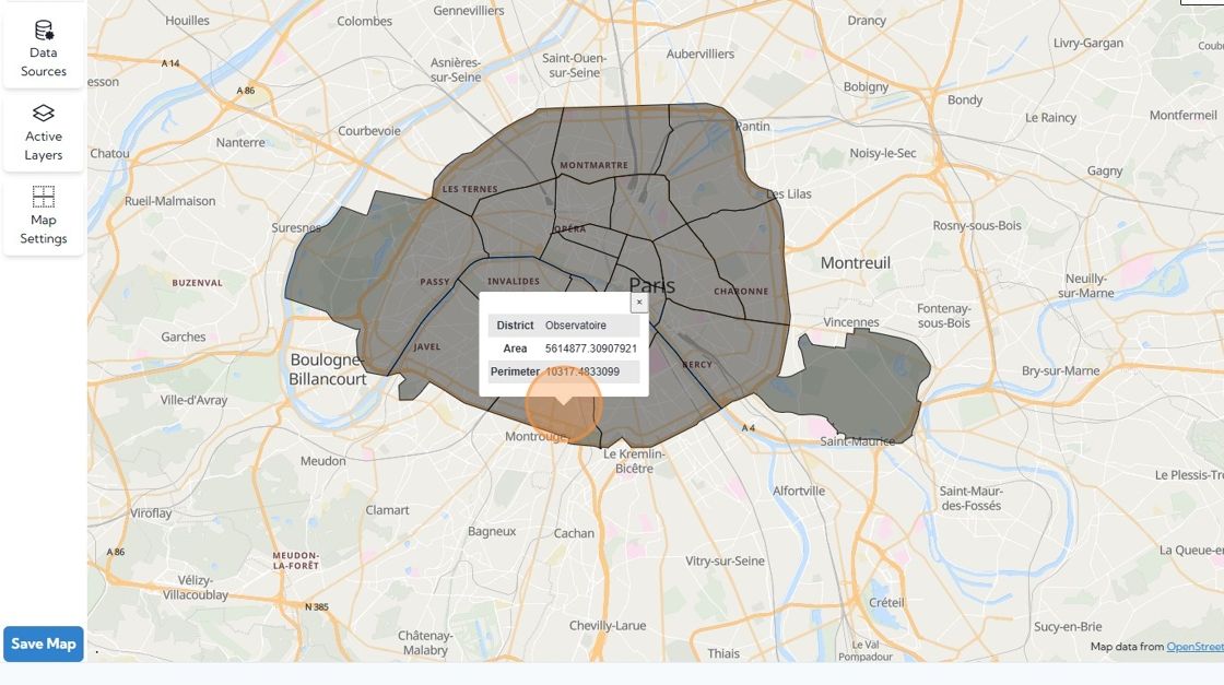
In this example, we have three points of data and we'd like to incorporate the District into our airtable.
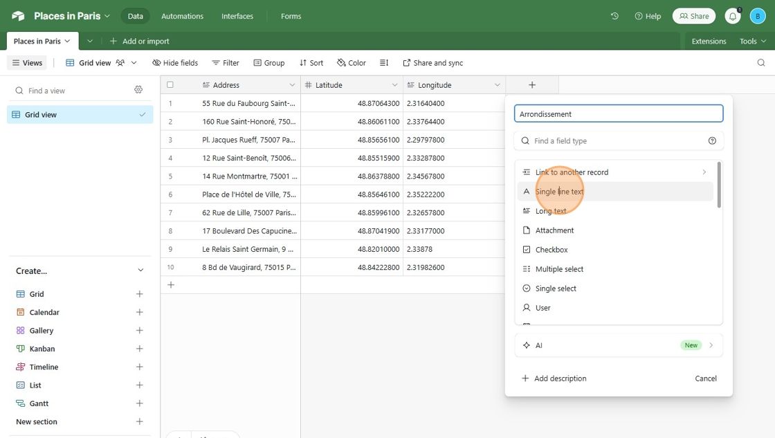
2. In Airtable, add a field for the geospatial data that you want to capture .
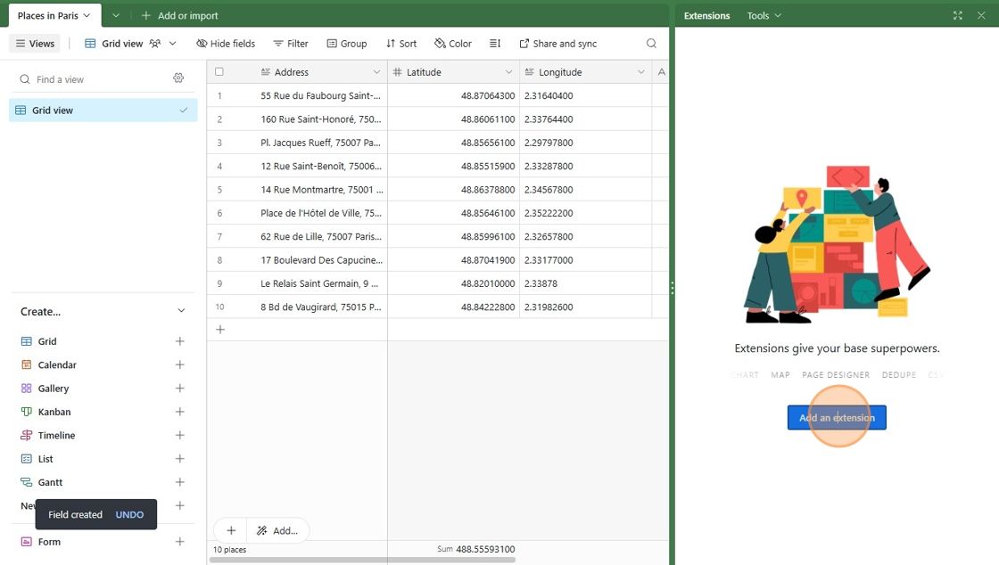
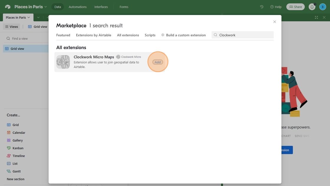
3. Add the Clockwork Micro Extension
Now you will Query the Clockwork Micro API Through Airtable with our extension. Search for "Clockwork Micro" and add the extension.
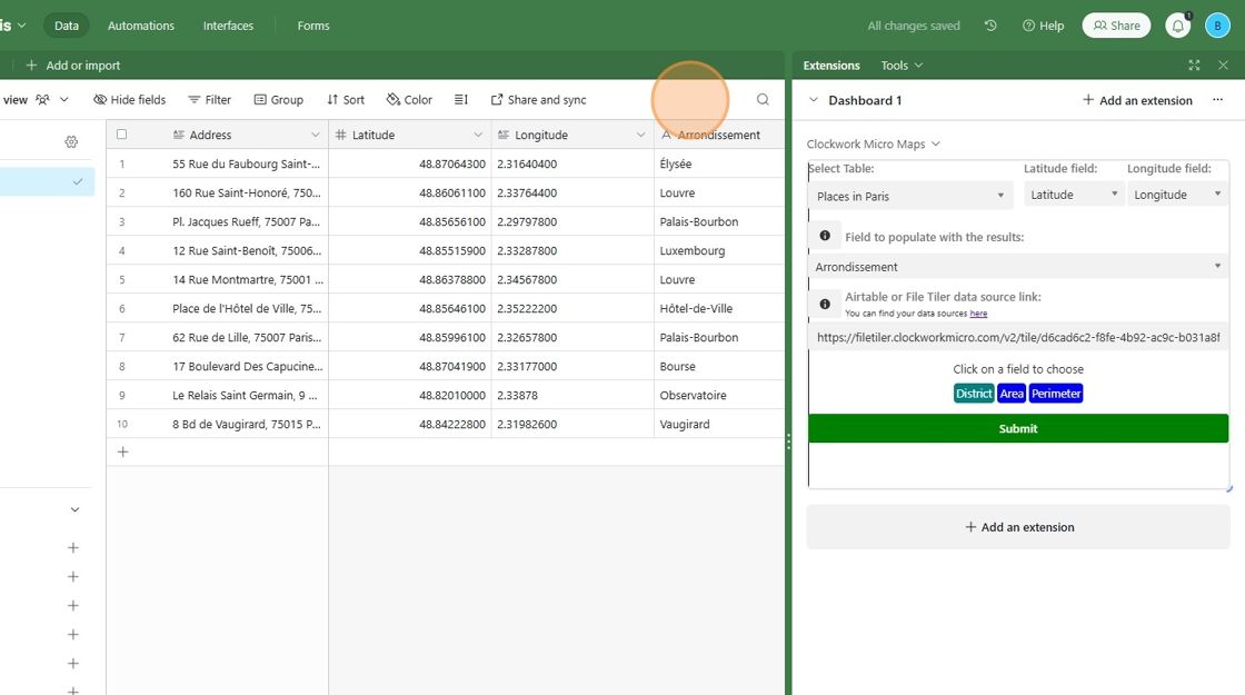
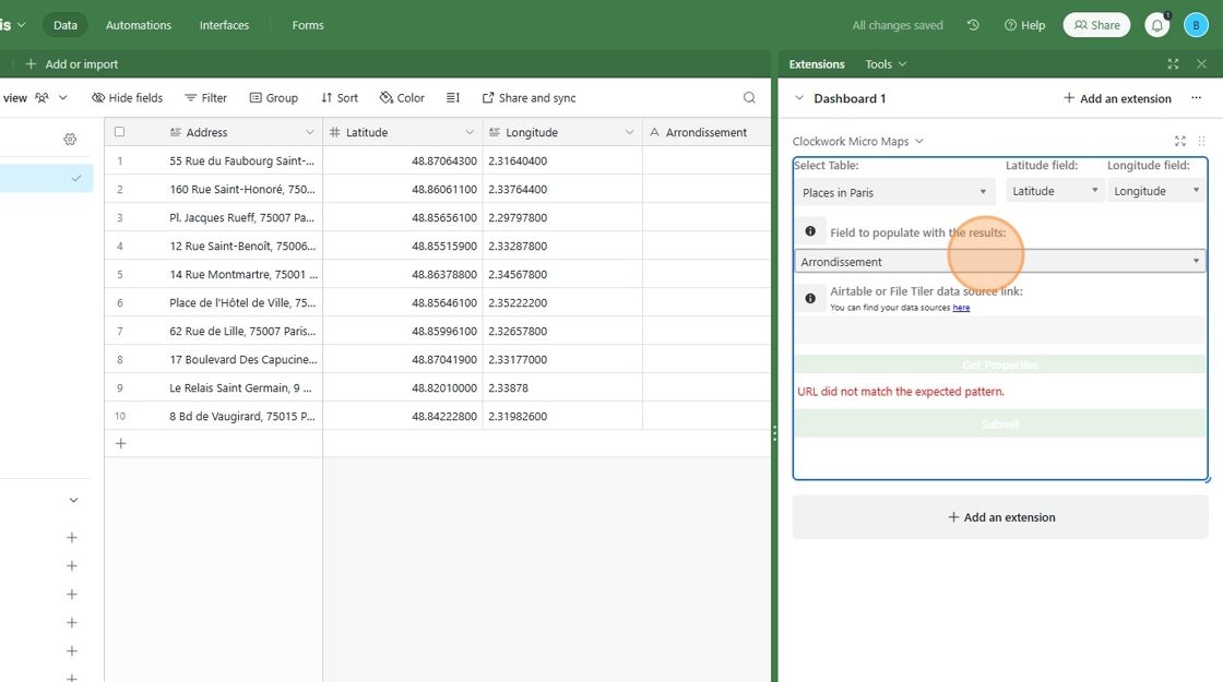
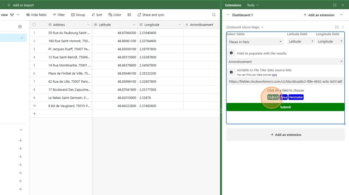
4. Fill in the Extension Fields
Choose your table and the fields containing the Latitude and Longitude coordinates. Then Choose the field that you created for the new data.
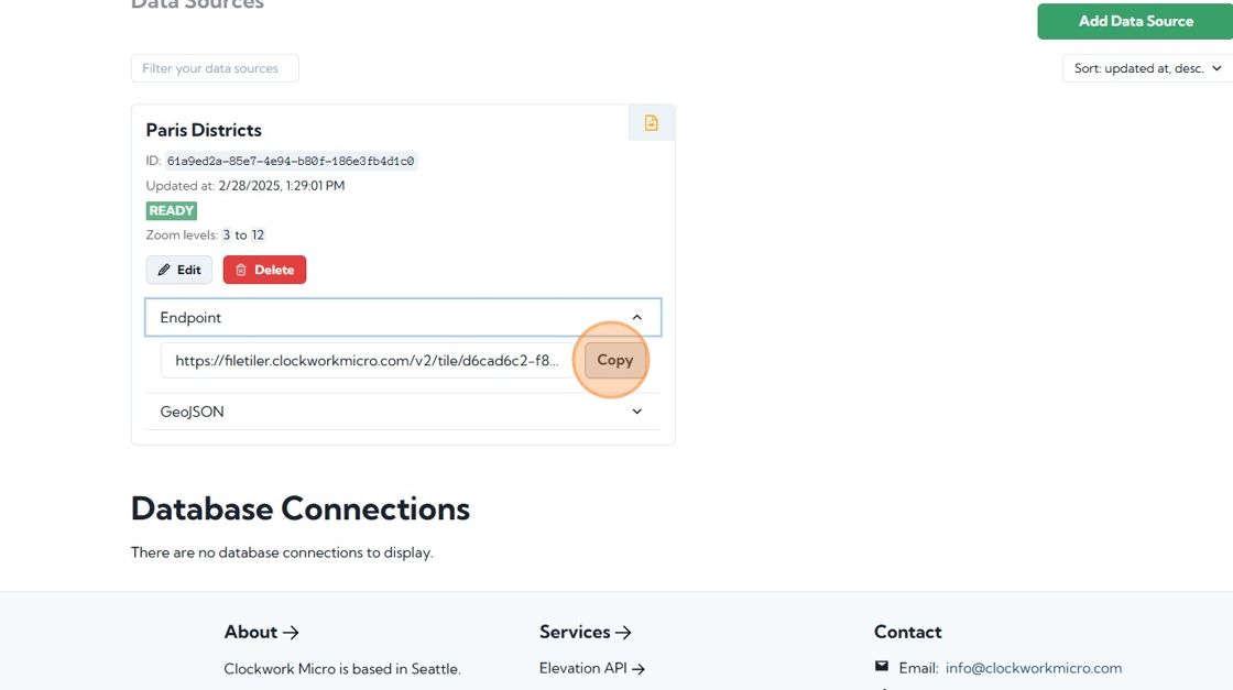
To get the Airtable or File Tiler link, return to Clockworkmicro.com and copy the Endpoint link for your data source.
Paste the link into the Airtable or File Tiler data source link field and click Get Properties.
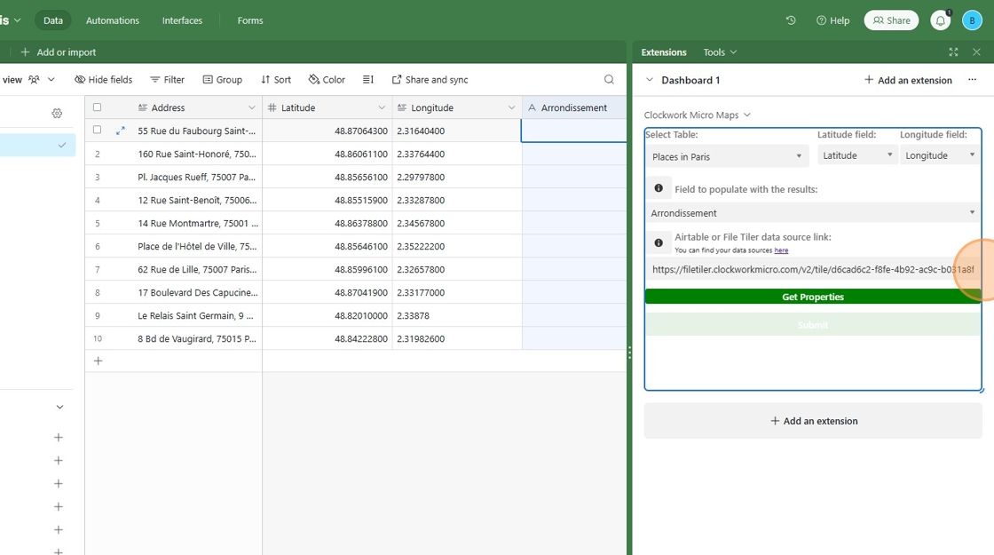
From the list of properties that the extension gets from your data source, choose the one that you want to add to your Airtable and click Submit.
That's it! The new data is now added to your Airtable.